WHAT'S NEW
Fresh trails!
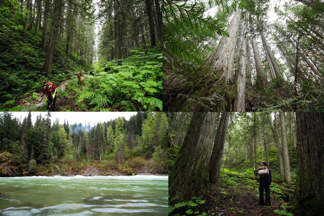
This summer, with funding from Yellowstone to Yukon’s (Y2Y) Partner Grant Program, Conservation North, Save-The-Cedar League, and local volunteers have worked to revitalize two trails in the Inland Rainforest east of Prince George: the Morkill Old Growth Cedar Trail and the Goat River Canyon Trail. Below are trail descriptions and directions, as well as a handful of pictures.
Please contact us if you have any questions (and let us know if you make it out to these trails and have feedback!). We are trying to let as many people know about them as possible to help wear them in.
Morkill Old Growth Cedar Trail. After a short distance through a regrown cut-block, this 4 km (roundtrip) trail follows a small creek through a unique valley filled with ancient, silvery redcedar and massive devil’s club. It ends at a ridge with a lone Douglas-Fir (we aim to extend the revitalized portion of this trail in coming years). The trailhead is located on the righthand side of the road just past the 11 km marker on the Morkill Forest Service Road near Crescent Spur, BC. Trailhead coordinates: (53.6493889, -120.6188333). If you visit, make sure you bring your gumboots, as the rainy weather we have had this summer makes for pretty wet conditions. We consider this a fairly easy 2-hour hike, though it does involve crossing a small creek a number of times. The entirety of this trail has been cleared, and we have affixed trailhead signage and trail markers through the initial portion in the regrown cut block.
Goat River Canyon Trail. This trail weaves through a lush and mossy old growth rainforest on a plateau above the Goat River, before descending into an area filled with 1000+ year old silvery redcedar. It ends at the rocky and tumultuous Goat River Canyon. We consider this a fairly easy 4-hour 8 km round trip hike, though it does involve crossing a small creek. Access to this trail is located off Highway 16, about 8km east of Loos Road. The trail is accessed by an old road on the south side of Highway 16, 1/2km before the Goat River bridge and rest area (coordinates: 53.4924063, -120.6176087). The old road is easily missed by those driving on Highway 16 because of the steep drop it takes off the highway. If you do not have a 4-WD vehicle, it is best to park at the Goat River rest area and walk west on the south side of Highway 16 to spot the rough access road. If you drive down the old road, there is a small clearing a short ways down with room to park. The hike initially follows the old road. You will cross a rough wooden bridge over a creek. Shortly afterwards, you will reach a fork in the road where the right side is very overgrown. Take the left fork. A short distance after this, there is a second fork in the road, where an ATV trail continues to the right and the left side is flagged. At this second fork, follow the left (flagged) side. After a minute or so, take the flagged trail on the left leading away from the old road and into the forest. From here, the trail is easy to follow. It has been flagged from start to finish.

