

Following massive public backlash, BC Timber Sales (BCTS) has suspended plans to log endangered caribou habitat in an area of rainforest north of Revelstoke, BC. BCTS had planned to auction off 11 cutblocks — an area totalling 276 hectares — and build 10 more kilometres of road into deep-snow mountain caribou habitat. As reported in the Narwhal, this is on hold thanks to the work of Wildsight, Echo Conservation and the Wilderness Committee.
What is BCTS? BCTS is a BC government program administered by the Ministry of Forests, Lands, Natural Resource Operations and Rural Development through its BC Timber Sales Branch. BCTS controls around 20 per cent of the cut on Crown lands — planning cut blocks and then auctioning them off to logging contractors. Most, if not all, of this cut comes from primary and old growth forests. Read more about BCTS in this engaging storymap
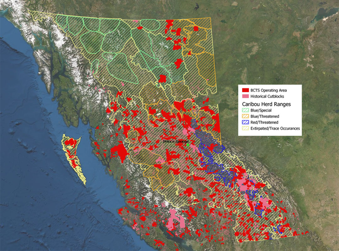
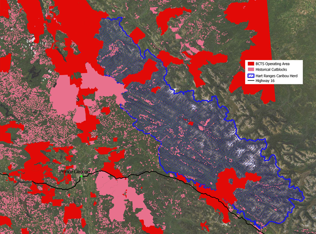
Want to know what BCTS is up to in our northern rainforests? We’ve created two maps to explicitly show the overlap between the BCTS Operating Areas (in solid red) and BC’s remaining caribou herds (cross-hatched colours). Map 2 shows a close-up of BCTS’ operating area in the northern rainforest, home of the Hart Ranges Caribou herd.
Want to find out what BCTS is auctioning off in your area? Follow these easy steps!
- Click here for the BC Bid website: https://www.bcbid.gov.bc.ca/open.dll/welcome?language=En
- On the home page, click ‘Browse for Bid Opportunities or Bid Results’.
- Then click either… ‘Browse opportunities by organization,’ (and then scroll down to ‘BC Timber Sales – Timber Auctions’, or ‘Services’ (and then scroll through the list until you see a BCTS posting).
- When you find a posting that interests you, (e.g., ‘TA0639, TCC, Quesnel Lake, Williams Lake Field Team’) click its document number, which will bring up a new window.
- In the posting window, click ‘Attachments’ in the top left corner. This will make a box with ‘Supplier Attachments’ pop up down below. Click it.
- Scroll through the attachments to locate an ‘Overview Location Map.’ This map will show you where the blocks that will be harvested are located.
- Return to the ‘Supplier Attachments’ window if you wish to download maps for the specific plots. These do not contain consistent data, though occasionally they will indicate Biogeoclimatic Zone for example, as well as other interesting facts (e.g., percentage of tree species to be harvested).